
Open Spaces Walk no. 3
By Clare Graham. Chair, Open Spaces Committee
Click + or - on the route map above to zoom in or out, or on the square symbol at the top and on the right to show it full-screen.
Walk no. 3: Two Commons and a Victorian Cemetery
Route description: Walk through Wandsworth Common, visit pretty St Mary's Cemetery and follow Battersea Rise downhill and uphill across the valley of the Falcon river before exploring the west side of Clapham Common, finishing on The Avenue beside Battersea Woods.
Start point: Wandsworth Common railway station, SW12 8SG.
Finish point: Clapham Common's new café building, SW4 9AZ.
Route length: 4.7 km/ 2.9 miles.
Facilities: Public toilets available at the beginning of the walk at Wandsworth Common station, refreshments and toilets at the Pear Tree Café beside Clapham Common Bandstand near its end.
Accessibility: Access from platforms 1-3 at Wandsworth Common station to the walk start point is via a stepped footbridge (no lifts). There are level foot and cycle paths across the three green spaces, with a steep cat's-back bridge to cross on Wandsworth Common. Elsewhere there are several busy roads to cross and downhill and uphill sections along the pavement of Battersea Rise.
Public transport links: Wandsworth Common railway station is also served by buses GI and 319. At the end of the walk, the 35 and 37 stop nearby on Clapham Common North Side; continue to Lavender Hill via Sugden Road for the 77, 87, 156 and 345. Clapham Junction, Clapham Common and Clapham South stations are all also about 15 minutes walk away.
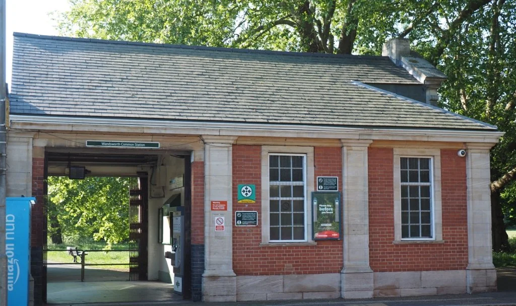
Start point: Wandsworth Common Station
The walk starts outside the station's ticket hall, next to the exit from platform 4. Look through the trees to spot The Hope pub, on the corner of St James's Drive and Bellevue Road. Make your way towards that along the station drive, or on the path through the grass. Then cross over Bellevue Road at the lights, and walk onto the Common.
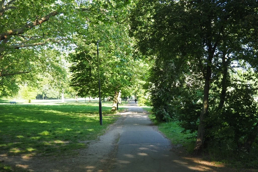
Wandsworth Common West
Take the central path stretching away straight ahead of you. Despite its name, much of Wandsworth Common lies within Battersea; today's walk is all on what was once part of the common land of the medieval parish of St Mary's Battersea. Its boundary with Wandsworth lies over to your left, marked by the presence of an ancient oak and some cast-iron Victorian boundary markers.
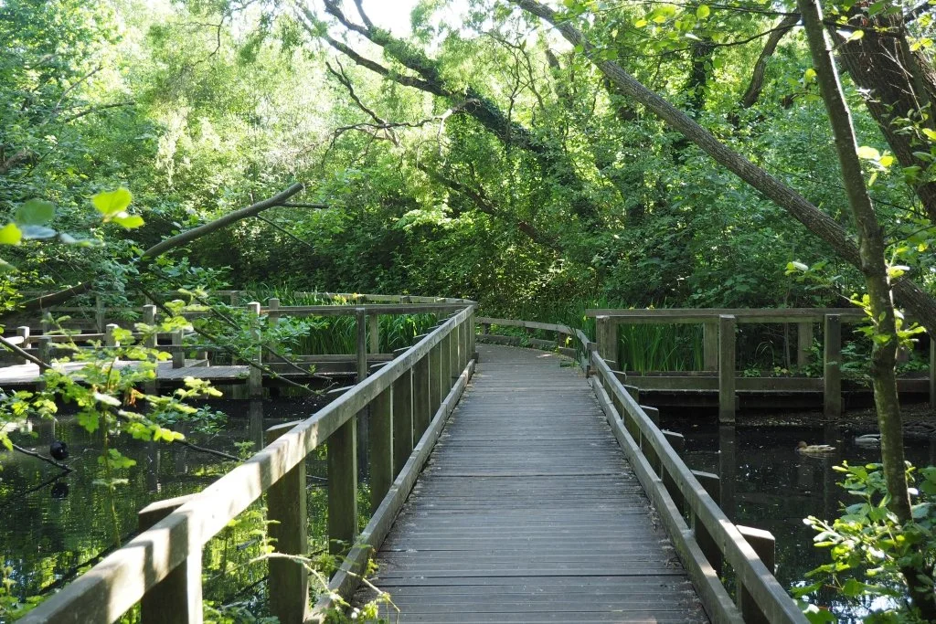
The Lake and Wetland
Soon on the right you will see a lake; take the path down towards this and at its edge turn left, following the path around it and then a boardwalk across the adjoining wetland. This lake is a great place to see some of the Common's many bats on summer evenings, as they flutter and swoop over the water in search of insects. At the end of the boardwalk, turn left. To your right in a cutting are the railway lines which transverse the Common. Soon comes a steeply-humped cat's-back bridge; use this to cross over them.
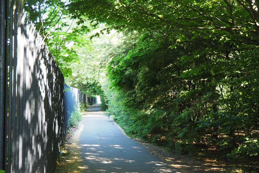
Wandsworth Common East
On the far side of the bridge, turn sharp left to follow a long straight tarmacked path. Iron railings shield the railway cutting to your left, and to your right is a belt of trees. Eventually the path curves right, between Wandsworth Council's Chivalry Road Playground and the specialist adventure playground created by play pioneer and children's advocate Marjory, Lady Allen (1897-1976). Come off the Common beyond the playgrounds, turning right onto Chivalry Road and then left onto Bolingbroke Grove.
St Mary’s Cemetery
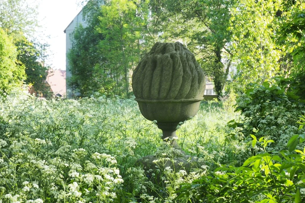
Cross Bolingbroke Grove at the zebra crossing, turn left again and soon enter St Mary’s Cemetery on your right. This was laid out by Charles Lee for the Battersea Burial Board in 1860-1, after the old churchyard at St Mary's (featured on walk 6) ran out of space for new burials. Its L-shaped site was previously part of the grounds of the Bolingbroke Grove House estate, broken up in 1858. One of the twin chapels ahead of you was for use by Anglicans, the other for other denominations. This cemetery too is no longer in active use, having run out of space for new burials in the 1960s. It's now managed to encourage biodiversity, winning a London in Bloom award in 2022. Take either of the paths to your left to walk through it, admiring the wildflowers and inspecting the monuments as you go. Quite a few of Battersea's great and good are buried here, but perhaps its most striking memorial is this sculpted bowl of fire at the far end of the cemetery, near the gates out onto Battersea Rise. This marks the burial place of a young Zorastrian Parsi, Kaikhoshru Kaicobad Puntheki (1864-1890); his story is told here.
St Mark’s and Battersea Rise
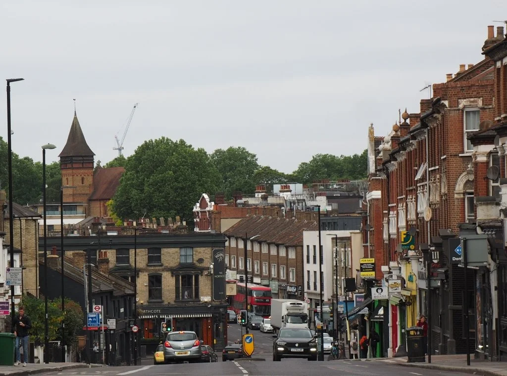
When you leave the cemetery, cross Battersea Rise to visit two isolated areas of Wandsworth Common on its north side. On one St Mark's Church (Anglican, 1873-4 by William White) draws the eye, with its polychrome brickwork and picturesque massing. Next, follow the left-hand pavement of Battersea Rise downhill and into the valley of the Falcon river, which has been buried since the 1860s beneath St John's and Northcote Roads. Cross their junction and continue uphill; look back for another pleasing view of St Mark's, this time set against trees.

Clapham Common: The Panhandle
At the top of Battersea Rise, cross over at the lights to enter Clapham Common. As with Wandsworth Common, its name is somewhat misleading; half was again common land belonging originally to the parish of Battersea, the rest to that of Clapham. These days the Common is split geographically between the boroughs of Lambeth and Wandsworth, but managed in its entirety by Lambeth. This walk again remains within the boundaries of Battersea, and Wandsworth. Take the main diagonal path across this first western section of the Common, sometimes known as The Panhandle. Although relatively small, it manages to pack in a recently-created banked area for butterflies to your right, a playground beside that, and further on an outdoor gym.
The Avenue and Clapham Common Westside
When you arrive at the far end of The Panhandle, turn right to visit four small areas of the Common sandwiched between The Avenue and Clapham Common West Side. You can either walk through these on earth paths and across grass, or walk beside them on Clapham Common West Side (which also offers some very substantial houses to admire). The first two fragments are managed to encourage biodiversity, and filled with wildflowers in spring; the third is mown grass, with an outdoor gym. Cross Broomwood Road to find the fourth, where a tarmacked area has an information panel giving the history of the low-level WW2 air-raid shelters formerly located here. Beyond that is a second recently-created banked area for butterflies, and another outdoor gym. When you reach a fence of low iron railings, turn left to walk beside it along a tarmac path towards The Avenue.
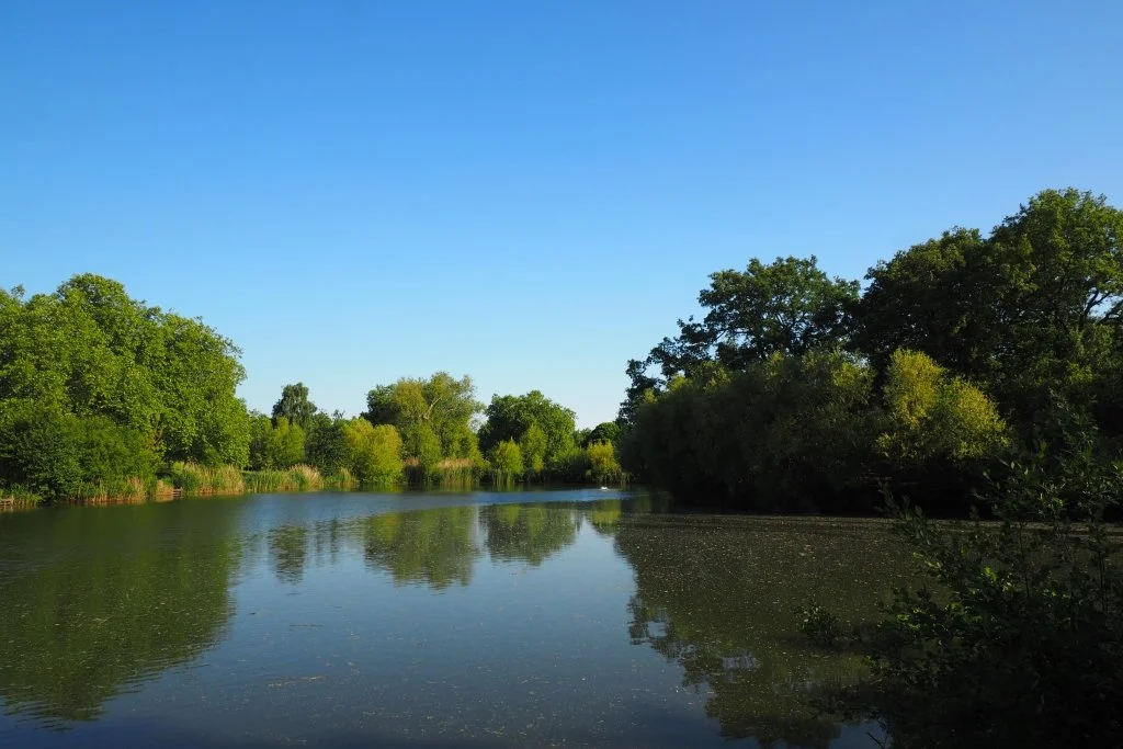
Mount Pond and the Bandstand
Cross The Avenue at the lights then walk down Windmill Drive towards Honest Tom's Snack Bar, beside Mount Pond. This pond started out as a gravel pit, but was taken over and improved in the 1740s by wealthy local resident Henton Brown. He introduced an island (the Mount), and also a long-vanished pagoda and bridge. Step down onto the boardwalk in front of the snack bar; follow that and then a path onwards, around the edge of the Pond. At the first junction carry straight on, towards the Bandstand at the centre of the Common. Local residents petitioned the newly-created LCC for a bandstand in 1889; in 1890 their wish was granted when this impressive structure went up. Designed by LCC architect Thomas Blashill, it's the largest in London. It's also located within Battersea, while the Pear Tree Café beyond is within Clapham; the boundary line runs between the two structures. Until the new café right at the end of this walk opens, the Pear Tree is a handy alternative refreshment stop.
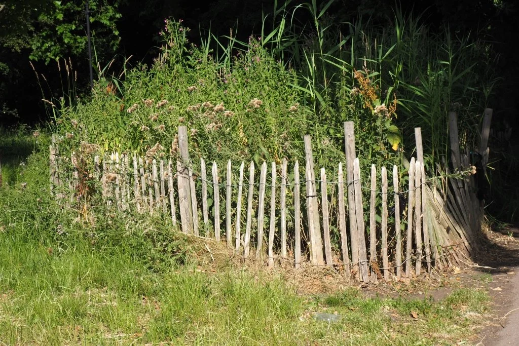
The Scrape and Battersea Woods
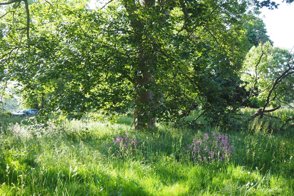
The walk route however remains within Battersea, as you turn left in front of the Bandstand and then take the second tarmac path on your left. Soon you will see this little fenced-off wild area, to your left ahead of a junction. It's a scrape, created relatively recently to help encourage amphibians, insects and other wildlife back onto Common. It's also done a good job of sorting out the puddles that previously plagued this particular area in wet weather. Carry straight on past it, and over the junction. To your right now are grass sports pitches, and to your left a wooded area rather grandly known as Battersea Woods. Up ahead is The Avenue again, just beyond the Common's own splendid avenue of horse chestnut trees.

End Point: Clapham Common's new café building
Walk on towards these, past some low black weatherboarded changing rooms for the sports pitches. Just beyond those is this attractive little building and garden, situated between the edge of Battersea Woods and one end of the horse chestnut avenue. Originally built as a toilet block, this was disused and derelict for many years, but has recently been restored and converted for café use. Hopefully soon it will be let and available as the refreshment stop at the end of this walk. Meanwhile, if you turn right beside it you can walk down the horse chestnut avenue to get to Clapham Common North Side, with its bus stops. Lavender Hill beyond has more bus options, accessed via Sugden Road.