
Open Spaces Walk no. 4
By Clare Graham, Chair, Open Spaces Committee
Click + or - on the route map above to zoom in or out, or on the square symbol at the top and on the right to show it full-screen.
Walk no. 4: St Philip Square to the Skylark Café
Route description: Walk southwards along the borders of east Battersea, looking out for Victorian boundary markers as you go. Discover some interesting recent biodiversity projects on the Lambeth side of Clapham Common, before exploring more of its Battersea side and the opulent area between it and Wandsworth Common. Finish at the café on Wandsworth Common.
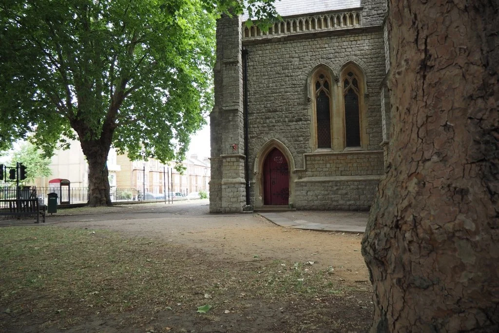
Start point: St Mary's (formerly St Philip's) Church, St Philip Square, SW8 3RS.
Finish point: The Skylark Café, Wandsworth Common, SW18 3RT.
Route length and map: 4.2 km/ 2.6 miles.
Facilities: Public toilets available midway, beside the old bowling green on Clapham Common. Refreshments and toilets at the end at the Skylark Café.
Accessibility: This walk is mostly on pavements and tarmacked footpaths; there may be some mud around Clapham Common's new Wetland Zone. It uses quiet roads wherever possible, but be prepared to walk beside and across a few busier ones. There are some gentle ascents and descents, and two steeper sections up Wix's Lane and over Wandsworth Common's cat's-back bridge.
Public transport links: St Philip Square is served by buses 137, 156 and 452 (Prairie Street stops) and is a few minutes' walk from Queenstown Road train station. At the end of the walk, the Skylark Café is near bus stops for the 77 (Windmill Road), 219 (County Arms) and 319 (Gorst Road), as well as Wandsworth Common train station. Or to walk to Clapham Junction (15 minutes approximately), follow the path on beyond the café past the bowling green and tennis courts; at the edge of the Common, take John Archer Way and walk over a bridge. Then turn right along Windmill Road. Cross over at the lights at its far end, walk down Strathblaine Terrace and Strath Terrace and onto St John's Hill; the station's Brighton Yard entrance is on its far side, just downhill.
Start point: St Philip Square
Start in the quiet, shady garden of the former Anglican church of St Philip (1869-70, architect James Knowles Jnr). Now known as St Mary's and home to an Ethiopian Orthodox congregation, it was built as the centrepiece of the Victorian Park Town Estate, a conservation area also featured on Walk 2. Cross busy Queenstown Road at the lights to visit Queenstown Green, a frankly rather bleak little open space created from a World War 2 bomb site. Back out on Queenstown Road, turn right and head south, towards Lavender Hill. Look out for a most unusual sight in the front garden of no. 67: a big grapefruit tree, recently in the news for its touching back story. Then, further on, when Queenstown Road starts to slope uphill, look out to your right and to your left for two pairs of round-topped Victorian cast iron markers, set into the pavement on opposite sides of the road. These record the parish boundaries of Battersea and Clapham (and of the modern boroughs of Wandsworth and Lambeth). In this area those follow the buried river Heathwall, again also featured on Walk 2.
Lavender Hill and Turnchapel Mews
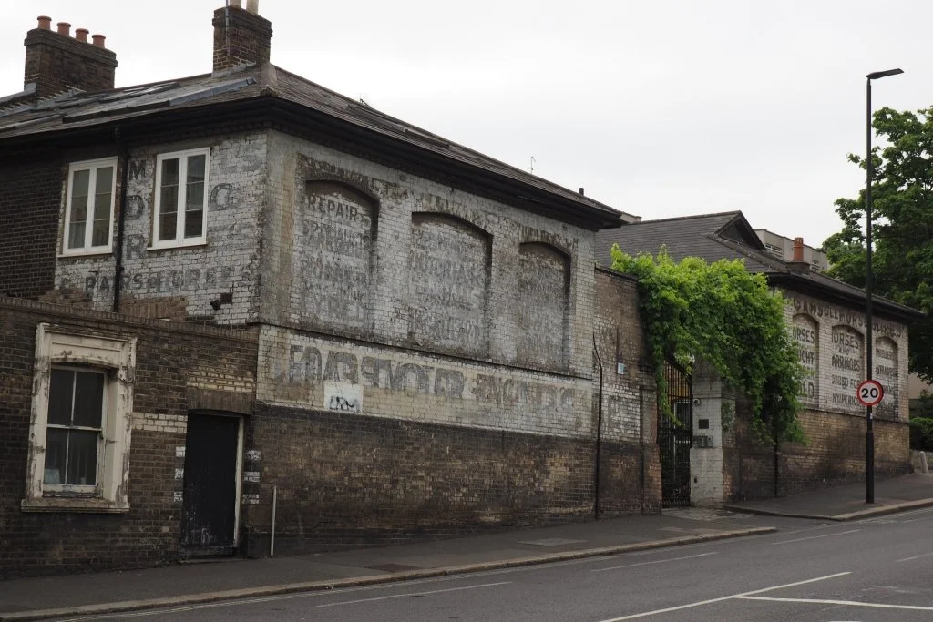
Continue uphill, briefly entering Clapham/ Lambeth. On the right is an embanked area of grass and trees at the end of Beaufoy Road, created from another pocket of WW2 bomb damage. At the junction, cross to the other side of Lavender Hill. Do take a quick look up Cedars Road on your left, to view this handsome old block on its far side. Built as livery stables and then converted into a garage, Turnchapel Mews is now housing but has had its old painted signage carefully preserved.
Wix’s Lane
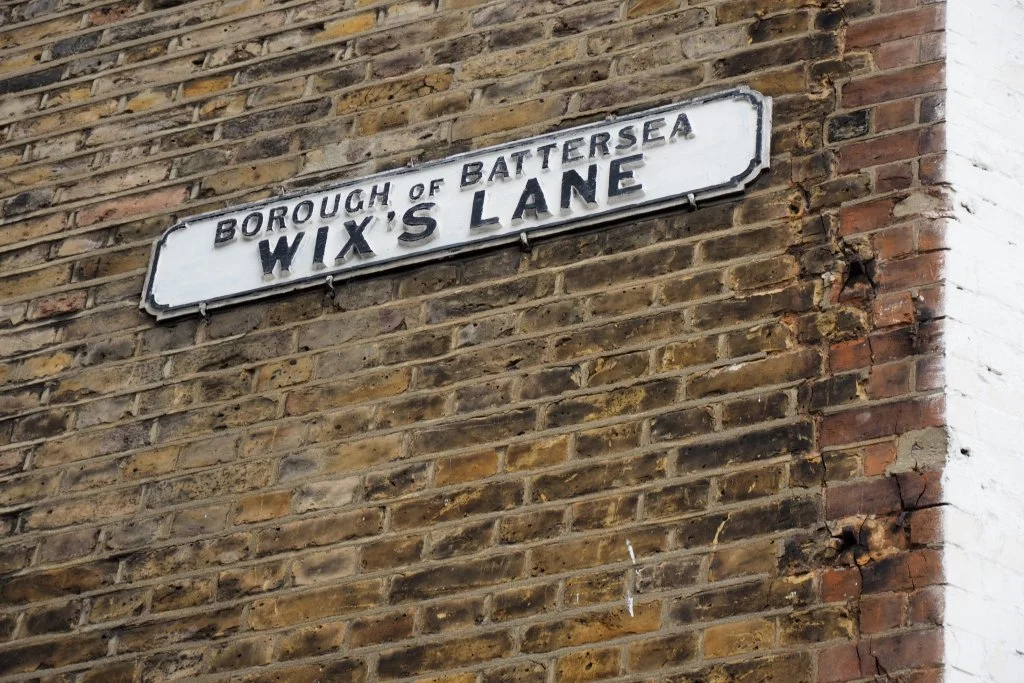
Return to Lavender Hill and start walking uphill, towards Clapham Junction. Look out on your left for the entrance to a foot passage sloping steeply uphill between two buildings. Set high on the far wall is this sign, which by the look of it dates from the early years of Battersea's period as an independent borough (1899-1965). Wix's Lane is Battersea's eastern boundary; as you turn up it, look to your left to find two more cast-iron markers set up by the Victorian parishes of Battersea and Clapham. There are others further along Wix's Lane, too. After the initial climb, this widens out into a proper road; follow that past the school and on to its far end, opposite Clapham Common.
Clapham Common or Battersea Common?
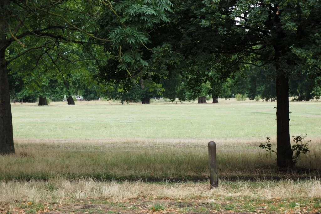
Standing at the top of Wix's Lane, look across to the Common: directly opposite is what should by now be a distinctly familiar-looking iron parish boundary marker. Beyond it another is just about visible in the distance, across the grass and under the trees. These are the first in a line marching right across the Common; the parish of Battersea's common grazing land lies to their right, Clapham's to their left. Each parish in fact owned about half of Clapham Common; these days however it's managed as a single entity by Lambeth Council. Turn left now and cross over busy Clapham Common North Side at the lights. On the far side turn left again, crossing over two cycle path exits with care. Then take the straight wide path on your right. This leads you onto the Common under a fine avenue of London Plane trees; a second path to your left is reserved for cyclists.
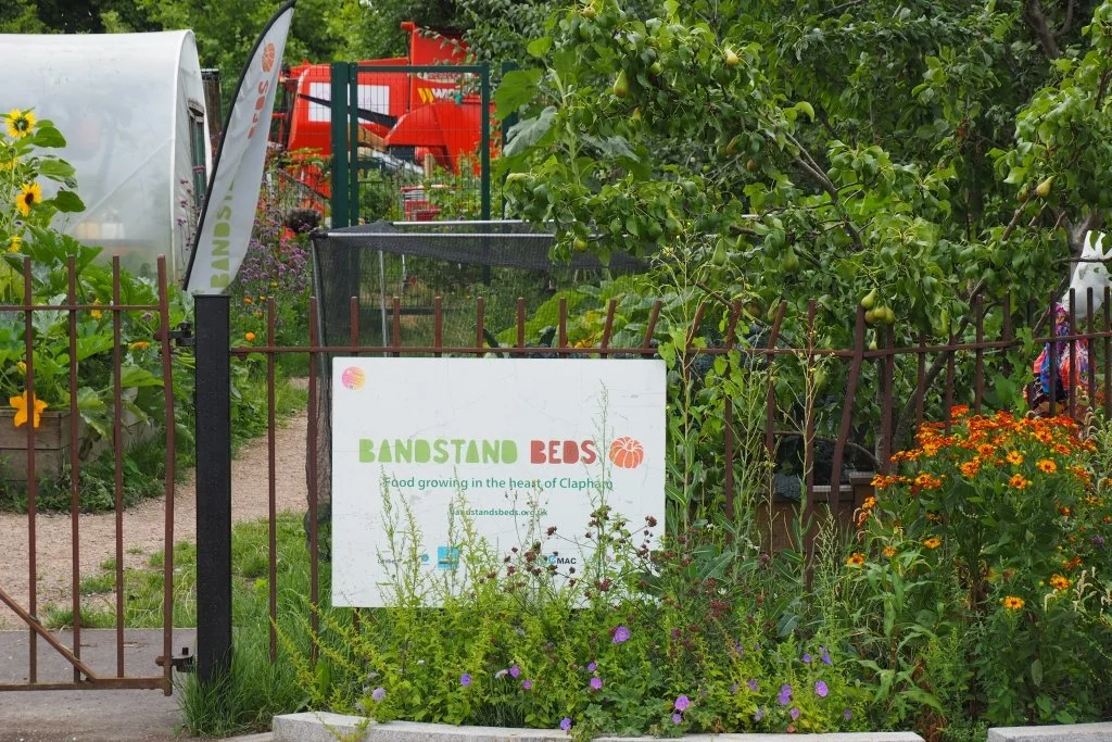
To the Bandstand Beds
Carry on straight ahead along this path, with the Common's handsome bandstand (visited on Walk 3) and Pear Tree Café to your right. Just beyond them is a junction of paths, and beyond that are the first indications of some interesting projects currently taking place on this the Lambeth side of the Common. Young trees are planted in informal groups, and new wildflower meadows draw in butterflies and other pollinating insects. Walk on between them until you reach this sign for the thriving Bandstand Beds community garden.
Community Gardening and Biodiversity Initiatives
Turn left now, onto a new pedestrian and cycle path which replaces part of the former Windmill Drive. It's attractively landscaped, with many more pollinator-friendly plants. Past maintenance regimes had left Clapham Common very nature-depleted, and it's good to see Lambeth Council's new emphasis on improving biodiversity, brought about with both pressure and support from the Common's own Management Advisory Committee and Friends, and local charity Wild Clapham.
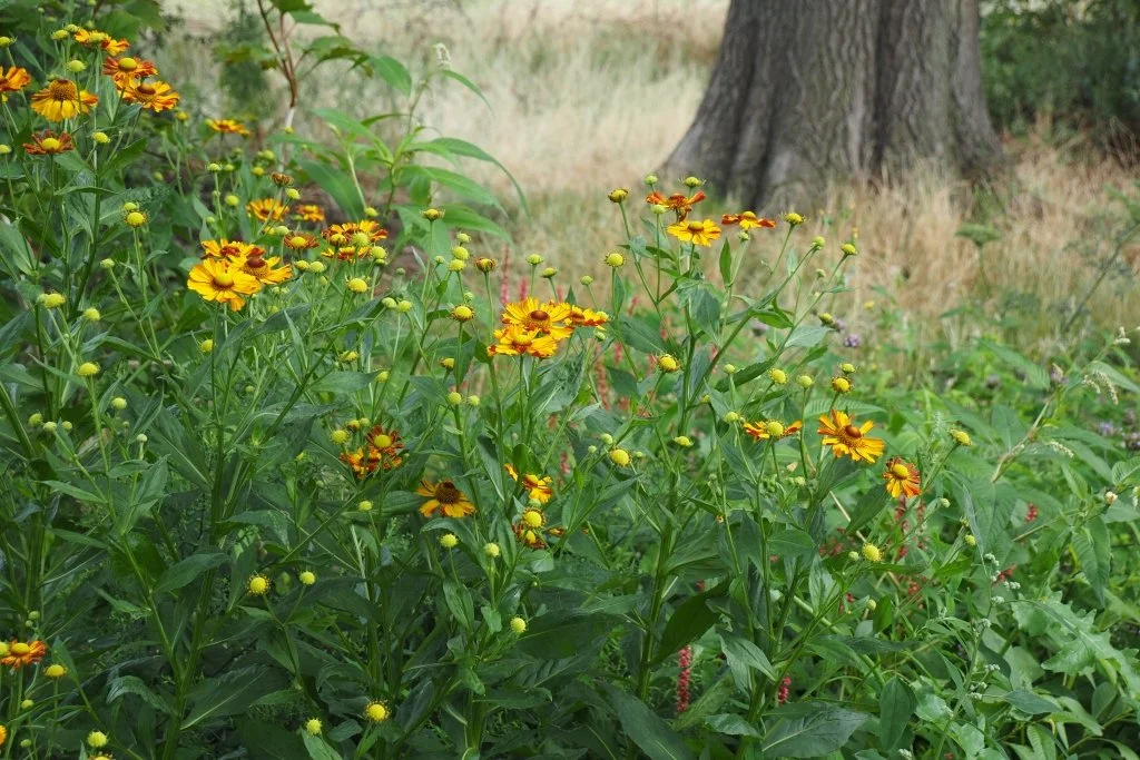
The Wetland Zone and Eagle Pond
At the end of the Bandstand Beds enclosure, turn right to visit the most recent and most ambitious of the Common's various new biodiversity projects: the Wetland Zone beside Eagle Pond. The pond at its centre was dug out in winter 2024-5; it also has a new boardwalk, a viewing bridge and a platform to allow pond-dipping visits by local schools. Plantings are still establishing, but it's already a hit with the local wildlife.When you've finished checking it out, head back towards the Bandstand Beds. Turn left as soon as you reach their railings, along a straight tarmac path.
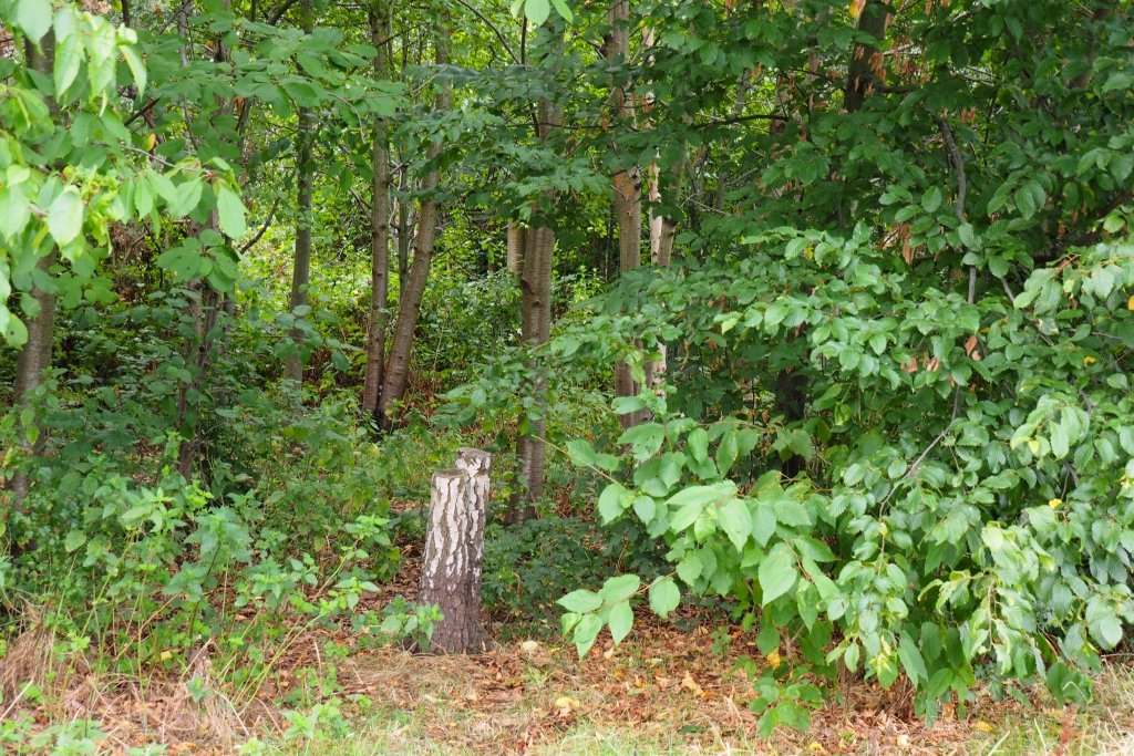
Nursery Wood and the Clapham South Subterranean Shelter
At a junction of paths carry straight on, with a wooded area to your left. This is known as Nursery Wood, since the London County Council used to grow trees here for its parks. Just before it ends, you re-enter Battersea; the last of the Common's line of iron boundary markers is actually inside Nursery Wood. If you'd like to find it, enter the wood via an earth path at its far end, and be prepared to hunt about a bit. Otherwise, just stay on the tarmac path until you reach The Avenue. Cross over that at the lights; on the far side, look left across the grass to spot on its far side the drum-shaped entrance to a well-preserved deep-level WW2 air-raid shelter, set amidst the trees. Clapham South Subterranean Shelter first opened in 1944, and is now maintained by the London Transport Museum; it can sometimes be visited on special tours.
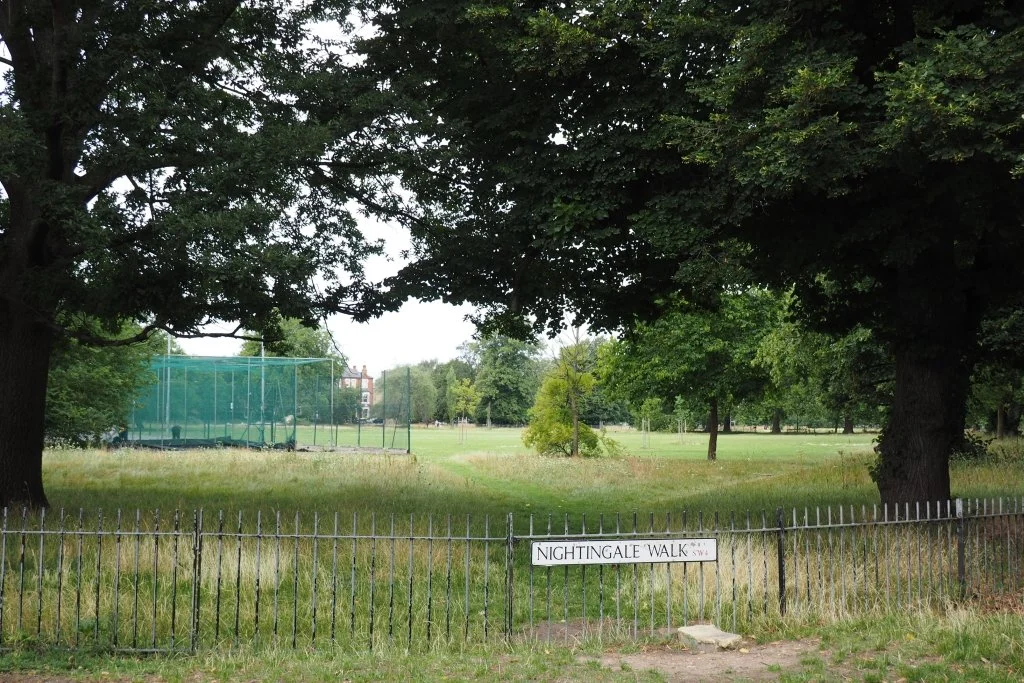
Nightingale Walk and Clapham Common West Side
Walk straight down Nightingale Walk, next; to your right is this fenced-off dog-free area of Clapham Common, with tennis courts, cricket nets and the beginnings of a community orchard. At the end, turn right down Clapham Common West Side, past its rose arbour (recently restored by the Friends of Clapham Common) and disused bowling green. A former café is currently closed up too, but there are still public toilets available should you need them. Turn left roughly opposite them onto Thurleigh Road.
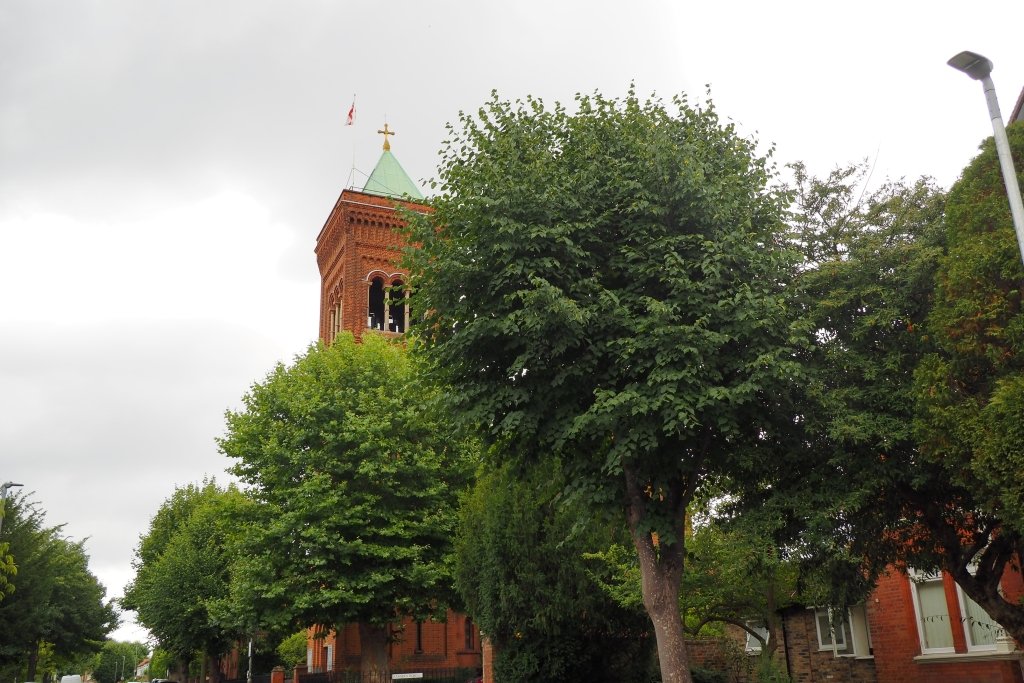
Thurleigh Road and St Luke’s Church
Leafy Thurleigh Road might just be the most desirable of all the desirable roads between Battersea's two commons; certainly it boasts some of the largest houses. It's also home to this red-brick Anglican basilica, St Luke's (F.W. Hunt, 1883-99). Should you find it open, do check out its lavish interior, dominated by an elaborate set of Edwardian electroliers. Beyond the church Thurleigh Road slopes gently downhill, then at the end slopes more abruptly up. This dip marks the valley of the Falcon River, now buried below and also crossed further downstream within Walk 3.
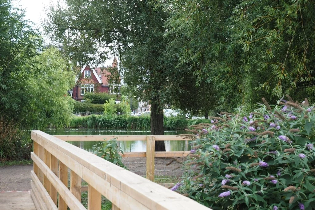
End Point: The Skylark Café, Wandsworth Common
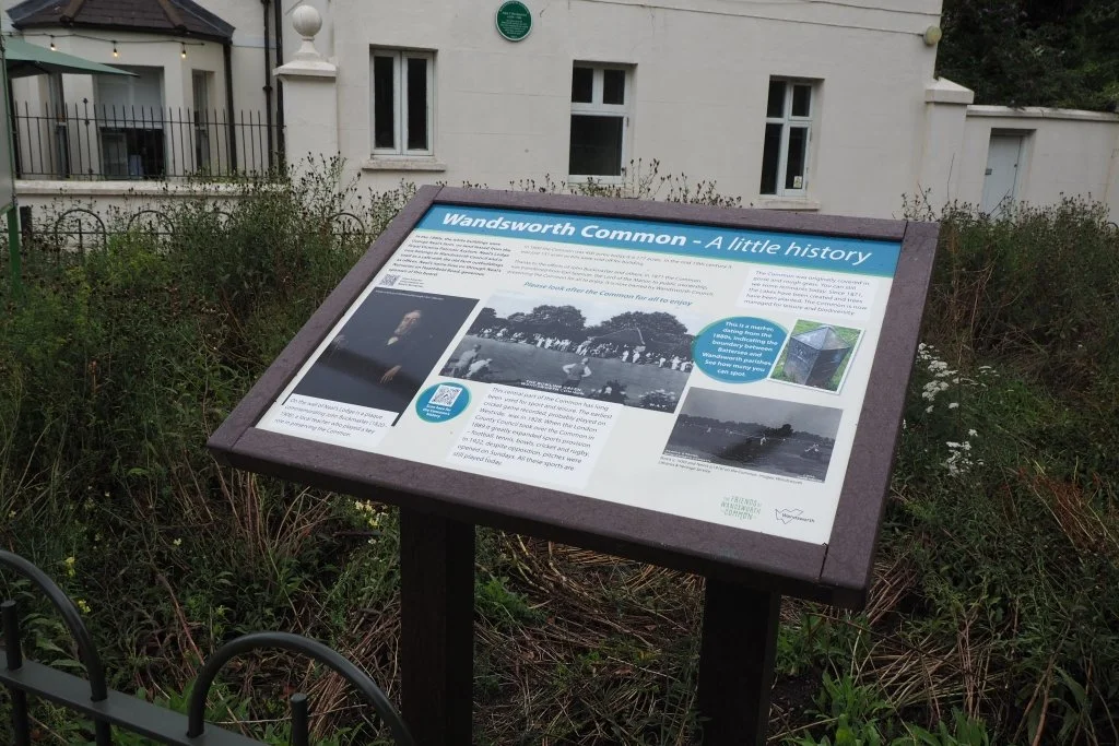
At the far end of Thurleigh Road, turn right onto Bolingbroke Grove. Cross over it at the lights, just beyond Blenkarne Road. Follow a path straight ahead of you under the trees and onto Wandsworth Common (also visited on Walk 3). Cross over the cat's-back bridge and take the first path on the right, towards the white building. Originally a farmhouse, this is now the Common's friendly community café and the end point of our walk. On your way over, look out to your right for this information board giving some interesting details of the Common's history. It's one of a set recently put up by the Friends of Wandsworth Common.