
Open Spaces Walk no. 6
By Clare Graham, Chair, Open Spaces Committee
Click + or - on the route map above to zoom in or out, or on the square symbol at the top and on the right to show it full-screen.
Walk no. 6: Thames Path West
Route description: Walk westwards along the river through Battersea Park and past Battersea's old parish church, with much else to see along the way - including the views across the river to Chelsea. Finish at The Waterfront beside Wandsworth Bridge.
Start point: Battersea Park's Chelsea Gate beside Chelsea Bridge, SW11 8NU.
Finish point: The Waterfront, Juniper Drive, SW18 1TS.
Route length and map: 3.9 km/ 2.4 miles.
Facilities: There are public toilets and a café near the start point, beside Battersea Park Children's Zoo. The end point is riverside pub The Waterfront. Other cafés are also available en route.
Accessibility: The Thames Path National Trail is accessible, mostly level and popular with both pedestrians and cyclists. Expect to cross busy roads at Albert and Battersea Bridges, and to divert briefly away from the river around the London Heliport.
Public transport links: Chelsea Gate has bus stops served by the 44, 137, 211 and 452. It's also a few minutes’ walk from Battersea Power Station Underground station (Northern Line) and Uber Boat Pier, and Battersea Park mainline railway station. At the end of the walk, catch a 44, 295 or C3 bus (Petergate bus stops, far end of Juniper Drive) or a train from Wandsworth Town mainline railway station (10 minutes’ walk). St Mary's Wandsworth Uber Boat Pier is also nearby.
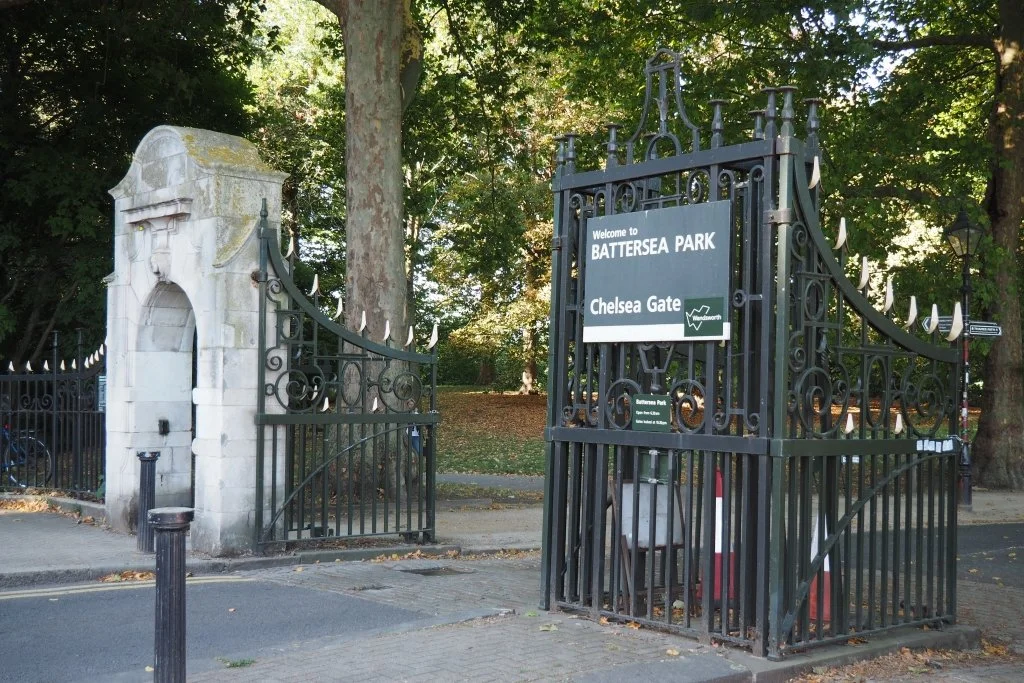
Start point: Chelsea Gate, Battersea Park
Battersea Park (Grade II*) replaced Battersea Fields, former parish common grazing land. By the mid-nineteenth century agriculture had given way to raffish riverside entertainment venues, cleared away to create this new central government funded 200 acre public park. Laid out by Sir James Pennethorne, it opened in 1858 and was to be much improved by its innovative first superintendent John Gibson. In 1889 the new London County Council took over the Park's care, organizing a ground-breaking public sculpture exhibition here in 1948 and a much-loved funfair within the 1951 Festival of Britain. Since 1986 it's been looked after by Wandsworth Council. Maps here and elsewhere in the Park guide you around its many attractions, but today take the first path to the right inside Chelsea Gate, which is marked with a Thames Path sign. This leads downhill to join the river at the point where Walk 5 left off.
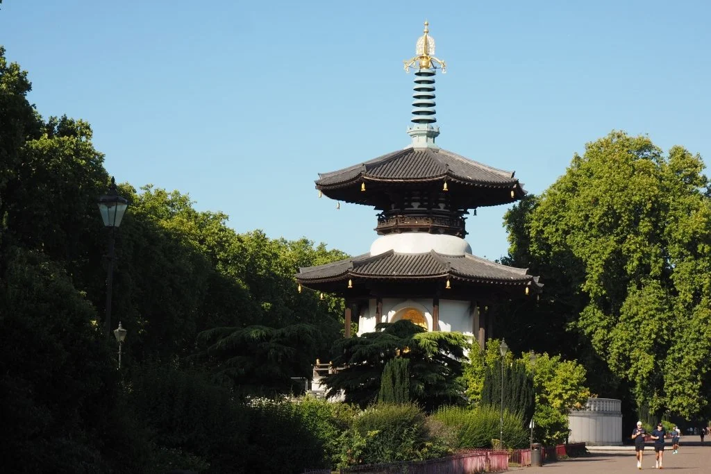
The Peace Pagoda
Head left along the Thames Path, which soon widens out into a formal riverside terrace. At its centre is a splendid and rather surprising sight: this glittering Peace Pagoda of 1985, with its four giant gilded Buddhas. It was a gift to the people of London from the Nipponzan Myohoji Buddhist Order and is still tended by a Buddhist monk. Controversial initially, it's become a much-loved symbol of Battersea, almost as celebrated as the Power Station downstream.
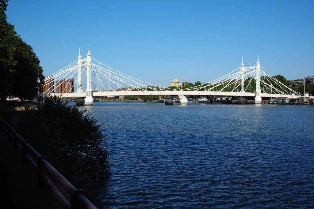
The Promontory Garden and Albert Bridge
Carry on upstream, looking out to your right for this Promontory Garden (2018, David Keary: no dogs) before you leave the Park. With its shady trees and benches, this is a good place to pause and appreciate the charms of Albert Bridge (1873, R.M. Ordish, modified 1884-7 by Sir Joseph Bazalgette; Grade II*). These are set off by a pink, green and blue colour scheme first dreamt up in 1992 to improve its visibility for passing shipping. (Prior to that it was painted plain yellow, and prior to 1981 plain green.) Pretty but relatively fragile, it's also sometimes known as the 'The Trembling Lady' thanks to its tendency to vibrate; surviving notices at each end warned troops from nearby Chelsea Barracks to break step as they crossed it. Outside the Park, cross over Albert Bridge Road at the zebra crossing, and reach the river again via a ramp.
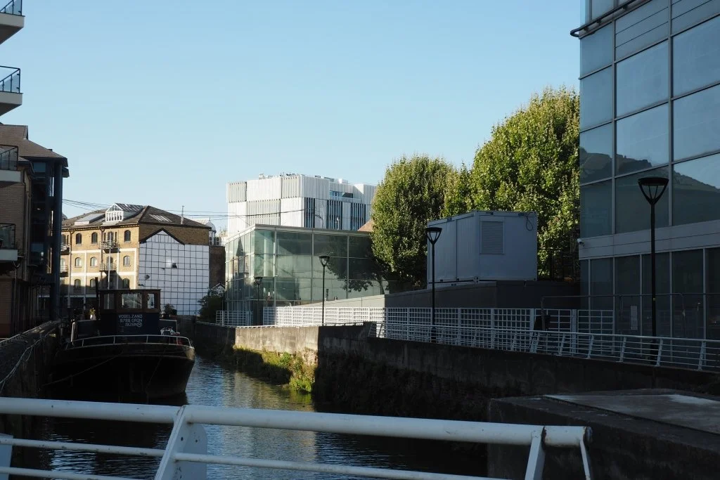
Ransome’s Dock and Albion Riverside
Next a footbridge takes you across Ransome's Dock, a former creek enlarged by engineering firm Ransome & Company in 1884. On the far side are architects Foster + Partners own rectilinear offices (1986-90), and beyond those their kidney-shaped Albion Riverside development (1999-2003). In front of that is moored National Historic Ship Atrato, a steel-hulled Thames sailing barge built in 1898 in Wivenhoe in Essex and currently used as a houseboat.
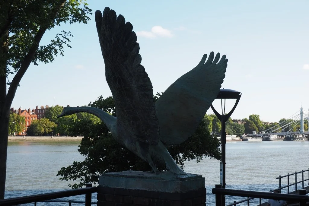
The Swan beside Battersea Bridge
Beside Battersea Bridge (1890, Joseph Bazalgette; Grade II) a somewhat confusing complex of platforms, steps and a narrow ramp leads up to the road. On it stands this rather lovely Swan (1984, Catherine Marr-Johnson), about to take flight over the river. Originally it had a companion, sadly destroyed by vandals. The pair were commissioned for Glassmill, the 1980s office development behind, now itself subject to redevelopment plans.
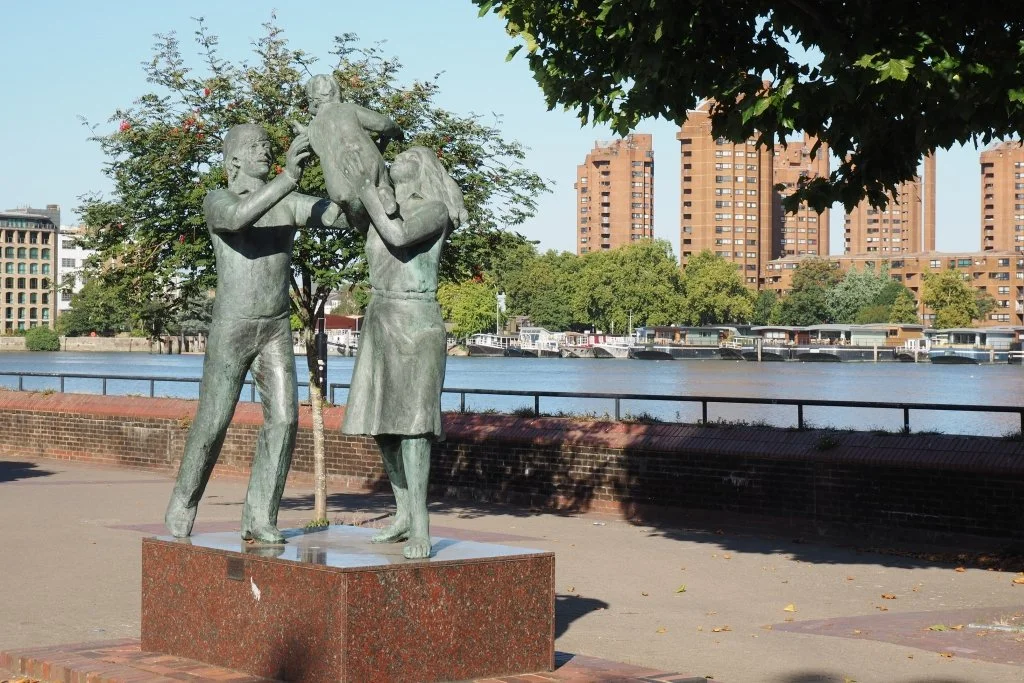
In Town and Morgan’s Walk
Beyond the bridge lies a garden area with a rather less successful sculpture: In Town (John Ravera, 1983). This little public space (on the site of a former fire station) and the adjacent stretch of Thames Path came about as a quid pro quo for the development of Morgan's Walk, the low-rise red-brick estate to your left (Wates, 1983-4). Built on the site of the old Morgan Crucible factory, this was one of the first luxury housing developments along Battersea's riverside. Its unexpectedly suburban layout led to it being described at the time as 'a yuppie Brookside'.
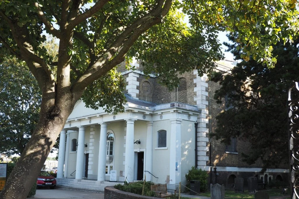
St Mary’s
After Morgan's Walk comes the raked profile of Montevetro (i.e. 'Glass Mountain'), Richard Rogers' apartment complex of 1994-2000 on the site of Battersea Flour Mills. Beyond that stands St Mary’s, Battersea's old parish church, finely positioned on a broad bend in the Thames. There's been a church here since at least 1157, though the current building is Georgian (1775-7, Joseph Dixon). It's well worth visiting should it be open; you will be welcome in any case to walk through its churchyard, ignoring Thames Path signage directing you around its boundary wall. Burials moved to a new cemetery in the 1850s (visited on Walk 3) and it's now become a public garden, with benches overlooking the river and a coffee trailer. As you leave it again, access to the foreshore is possible for once, via a slipway for small boats.
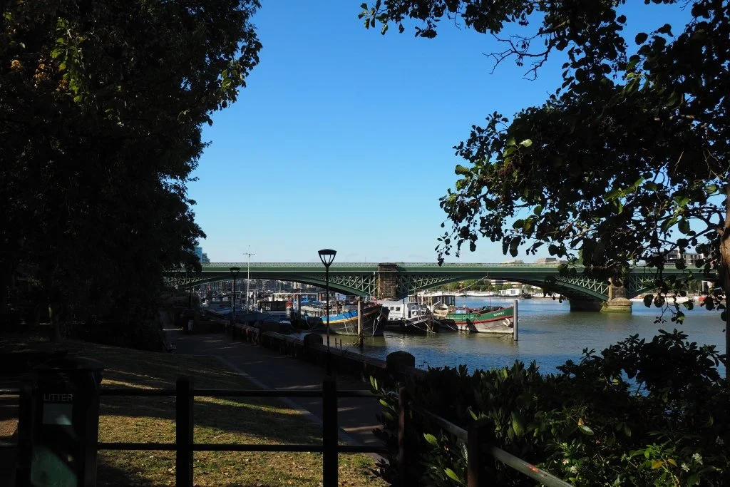
Vicarage Gardens and the Railway Bridge
Walk onwards to discover Vicarage Gardens, a small open space with trees and beds and benches on top of an embankment beside the Thames Path. This was first laid out as a public recreation ground by Battersea's Vestry in 1896, when it reclaimed an area of Thames foreshore and built Vicarage Crescent behind you. Climb up to admire the view over the river to handsome Battersea or Cremorne Railway Bridge (1863, William Baker and T. H. Bertram; Grade II*). Plans to attach a footbridge across the Thames to this exist, but are not currently in development. Looking the other way, Fred Wells Gardens (Walk 1) are visible beyond Vicarage Crescent.
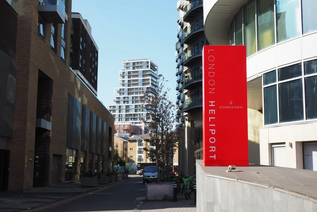
Around the Heliport
Walk under the railway bridge and onwards. You will find yourself detouring to the left eventually, around The London Heliport. This has been here since 1959, occupying a site directly beside the river and partially built out over it. Pass by at the right moment and you may get to see a helicopter being flown in or out. Beyond this terminal building, a black Thames Path sign directs you back down to the right, and the river.
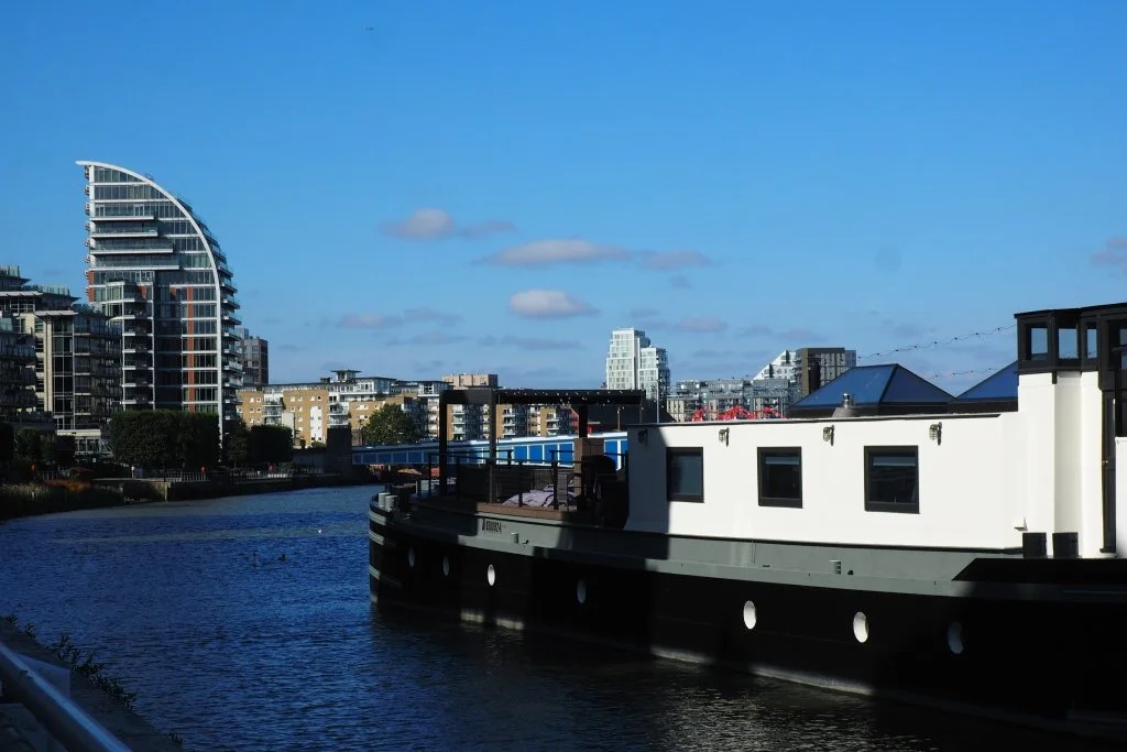
Towards Battersea Reach
Next up to your left is the red-brick Plantation Wharf development, built in the 1980s and 1990s. To the right is its Uber Boat pier, now known as St Mary’s Wandsworth. This feels confusing, given that St Mary's Church is now half a mile back—and that we remain still within the boundaries of Battersea. Look ahead to spot the end point of this walk: the towers of Battersea Reach (St George plc, 2002 onwards). Despite its name, this development is actually situated within Wandsworth.
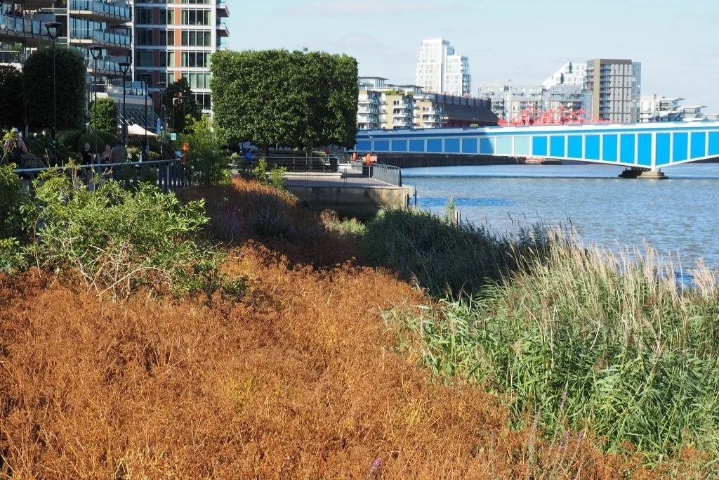
The Thames and Biodiversity
The boundary between Battersea and Wandsworth is just west of Mendip Road, beside this artificial estuary edge on an otherwise-barren foreshore. As we saw at the Isle of Effra at the beginning of Walk 5, re-introducing biodiversity to an embanked and fast-flowing tidal river has its challenges. This was a pioneering effort by the developers of the adjacent residential block, back in 2005; a 2017 report concluded that, though not as well-designed as it might be, it does perform a useful role.
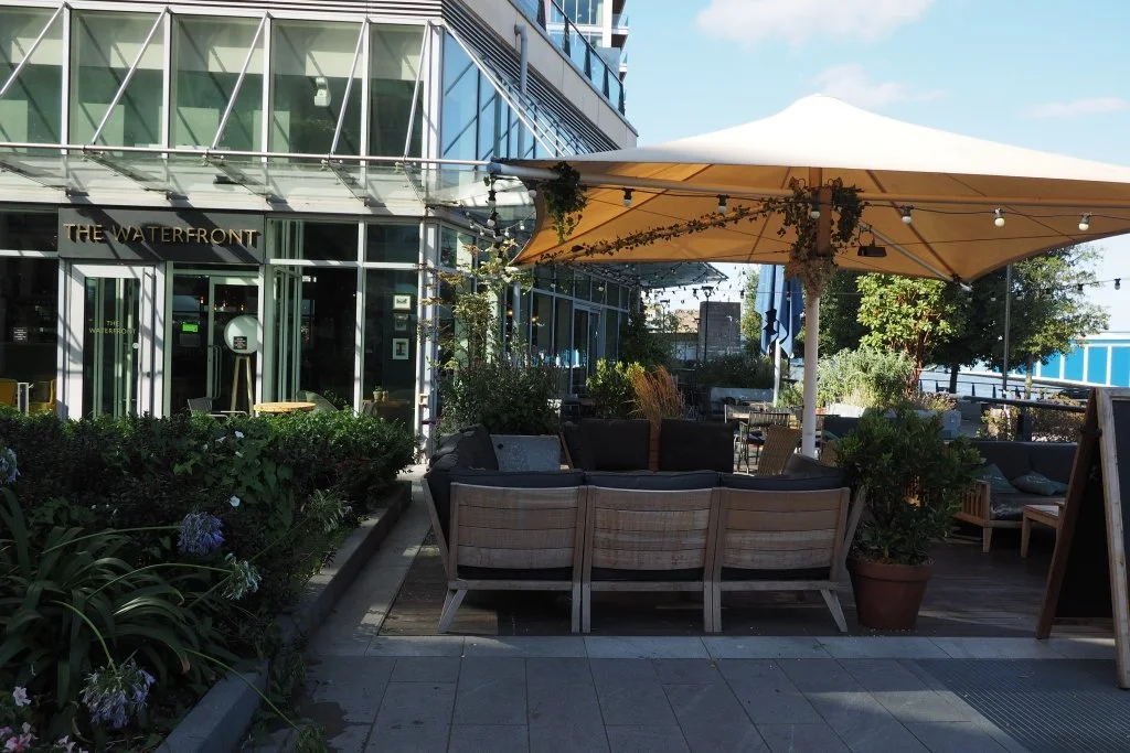
End point: The Waterfront
The walk finishes at this friendly all-day riverside pub, just before Wandsworth Bridge (1940, T. P. Frank). Utilitarian in design and painted blue, the bridge has been described as London's dullest—but after dark it’s now become a whole lot more interesting, thanks to a glamorous new colour-changing lighting scheme provided within Wandsworth London Borough of Culture Year. So: an appropriate place to end this last of a set of walks created to mark that.